
GOOGLE MAP
SATELLITE
BASE MAP
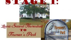
Distance: 9 km – Average Walking Time: 2 hrs.
Stage 3 of the Laura Secord Legacy Trail begins at the transit loop at Niagara College. Stage 3 is the most urbanized section of the walk, taking you through urban parks and along city sidewalks. Much has changed since the day Laura Secord passed through the small settlement of Shipman’s Corners. This stage of the walk provides you with a fascinating overview of how industry, transport, population growth and economic development have caused the landscape to evolve in the past 200 years.
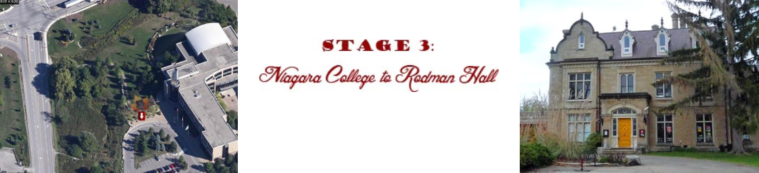
![]() Stage 3 begins at the bus stop under the big blue ‘nc’ logo, at the main entrance to Niagara College (small white arrow in photo).
Stage 3 begins at the bus stop under the big blue ‘nc’ logo, at the main entrance to Niagara College (small white arrow in photo).
 At the Outlet Collection at Niagara mall, you have two choices: 1) follow the sidewalk along Taylor Road to bypass the mall, or 2) indulge in some refreshment or retail therapy by walking through the mall. It is indeed a bit unusual for a walking trail to cross directly through a shopping mall, but the Laura Secord Legacy Trail is no ordinary trail! The circuit through the mall provides an opportunity to stop, rest, use the washroom facilities, and perhaps grab a bite at the food court before continuing on your way
Walk along Taylor Road in front of Leons Furniture and pass the intersection with Homer Road (named after the all-but-forgotten Village of Homer that Laura Secord walked through on her trek). Carefully cross Homer Road at the intersection of Taylor Road, then follow Taylor Road west. Taylor Road will curve north and approach the Garden City Skyway at the York Road traffic lights. Turn left at the intersection of York Road (which soon becomes Queenston Street), and walk over the Homer Bridge across the Fourth Welland Canal (formerly Ten Mile Creek).
You’ll follow urban sidewalks along Queenston Street (the old Iroquois Trail) past tranquil Victoria Lawn Cemetery, then head west on Eastchester Road to Centennial Gardens. The parklands of Centennial Gardens surround the valley of Dick’s Creek, where the First Welland Canal was located.
 The paths and trails of Centennial Gardens provide a welcome – and very historic – green oasis in the heart of St. Catharines. At the foot of Eastchester Road, you will pass a plaque honouring another hero of the War of 1812, Captain Richard ‘Dick’ Pierpoint – a former slave who became one of the first free Black settlers in the region, serving with Butler’s Rangers and founding the celebrated Coloured Corps who aided the British in the War of 1812. DIck’s Creek is presumed to have been named after him, as he was granted land in this area in recognition of his loyal service to the British crown
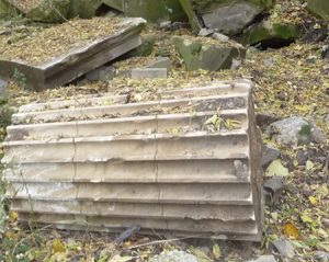 Further down the path, you will be able to discern the edge of Dick’s Creek, the watercourse presumably named in Pierpoint’s Honour. Nearby are the totem gardens and the oddly picturesque architectural debris of the demolished Carnegie Library, displayed in a haphazard but strangely attractive garden setting near the edge of the park.
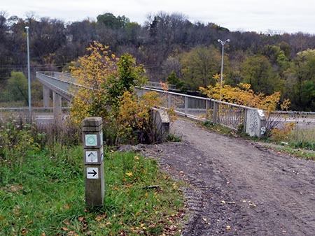
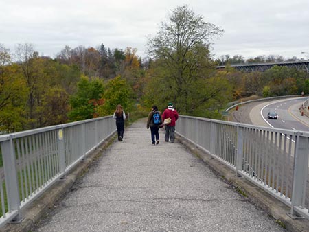
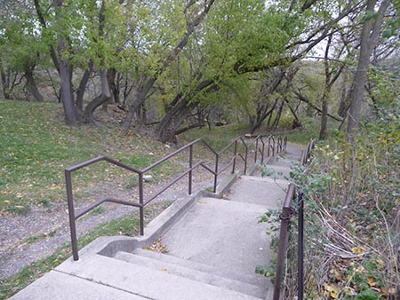 You will ascend the stairway to Gale Crescent, cross Geneva Street, and travel southwest on Race Street to the intersection with the Merritt Trail at the foot of St. Paul Crescent, where you will cross over busy Highway 406 on a pedestrian footbridge (below left) and enter the valley of Twelve Mile Creek (below right).
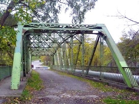
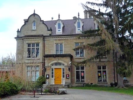
Next, you will follow the edge of Twelve Mile Creek and cross over to the west bank on the St. Paul Crescent truss bridge (below, left), wending your way up the hill to the manicured grounds of historic Rodman Hall (below, right). Stage 3 ends at the front door of this noble edifice, now a public art gallery.
Add comment